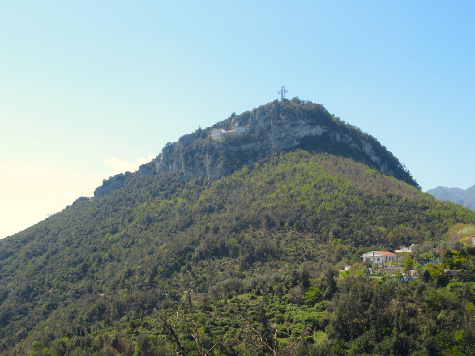
From the City of Salerno to Monte S. Liberatore
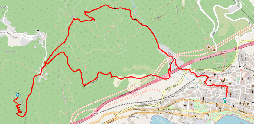
The route begins by climbing Via dei Canali, passing by the church of S. Andrea Apostolo, then continuing along Via Torquato Tasso to the Giardini della Minerva. The trail proceeds through Via Porta S. Nicola and Via De Renzi, crossing Via Alfonso Gatto to reach the Canalone district, below the motorway viaduct.
At the end of Via Temistocle Marzano, the route enters a natural environment, initially following an unpaved road alongside the stream known for the devastating flood of 1954. Climbing through a shaded valley covered by Mediterranean scrub, hikers reach the boundary marker between Salerno, Vietri sul Mare and Cava de’ Tirreni (390 m altitude).
From here, the path descends approximately 100 metres to the natural saddle of località Valle. In this area, visitors can see an ancient farmhouse with a cistern (peschéra), the so-called quercia di Manfredi, where the Swabian ruler is believed to have stopped before the Battaglia di Benevento, and a Lombard tower once used for pigeon hunting.
On the left is trail 120A, recommended for the return journey, while on the right is the small road arriving from the Alessia district of Cava de’ Tirreni. The final ascent follows a mule track around Monte S. Liberatore.
Shortly before the southern slope, hikers encounter equipped climbing walls, among the first built in Campania and still very popular today. Continuing onwards, the trail reaches the panoramic Eremo di S. Liberatore, documented as early as 980.
Today, the right nave of the church is still used for worship, while the left nave, once used for the burials of Benedictine nuns, now serves as a welcoming space for pilgrims.
Leaving the hermitage behind, the path climbs through grassy and rocky terrain to the summit of Monte S. Liberatore, marked by a large 15-metre-high steel cross, illuminated and visible even at night.
From the summit, visitors can enjoy a 360° panorama including Monte Stella, La Bastiglia, Castello di Arechi, Monte Tubenna, Salerno, the Piana del Sele, the Alburni, and the Cilento mountains as far as Punta Licosa. On the opposite side, the Monti Lattari, Monte Finestra and the first peaks of the Monti Picentini can be seen.
For the return journey, once back at località Valle, it is recommended to follow trail CAI 120A. The route offers a fascinating contrast between the built landscape (motorway, city and port) and the natural environment, characterised by rock formations and Mediterranean scrub.
The long panoramic descent leads to a ruin with pointed arches, possibly a fortified farmhouse, offering a wide view over Salerno and its port. Following Via della Valle, the route passes near villa Picco del Nibbio and reaches the Canalone district again, from where the return to the historic centre follows the same route as the outward journey.
Variant
- The Alessia area can be reached by car; starting from here, the climb to Monte S. Liberatore is reduced to approximately 1 hour and 30 minutes, with an elevation gain of 170 m.